As an Amazon Associate, we earn from qualifying purchases. Some links on this site are affiliate links at no extra cost to you. Our recommendations are based on thorough research and editorial judgment.
How GPS and GNSS Systems Work in Camera Drones
GPS and GNSS systems are essential for the operation of camera drones, providing critical navigation capabilities through satellite connections. These systems help determine precise positioning by receiving signals from satellites, typically requiring at least six for basic accuracy. With improved connectivity to multiple satellites, we can achieve accuracy within 1-2 meters. This technology allows drones to follow designated paths, hover steadily, and guarantee safety through features like Return-to-Home. There’s much more to uncover about how these systems enhance drone performance.
Key Takeaways
- GPS and GNSS provide essential satellite signals that enable camera drones to navigate accurately and maintain steady flight paths.
- Drones need a connection to at least six satellites for basic positioning, with more satellites enhancing accuracy significantly.
- Triangulation, using signals from multiple satellites, helps determine the drone’s precise location, crucial for high-quality aerial imagery.
- Advanced GNSS technologies like RTK deliver centimeter-level accuracy, improving camera drones’ performance in various applications, including mapping and photography.
- Multi-constellation GNSS receivers ensure reliable communication, increasing drone usability even in challenging environments with potential signal obstructions.
The Role of GPS and GNSS in Drone Navigation
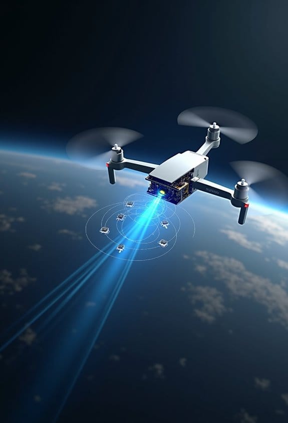
Have you ever wondered how GPS and GNSS work together in drone navigation? These systems are pretty fascinating and play a vital role in making camera drones super efficient. Basically, they help drones understand where they are by connecting to satellites in space. When a drone links up with at least six satellites, it can figure out its exact position. Ideally, grabbing signals from ten to twelve satellites can really enhance accuracy. This means your drone can hover steadily in one spot or follow a planned flight path all on its own, even managing to return to you in case of an emergency.
For instance, if you’re using a drone for a mapping project, the GNSS will provide key details like altitude and speed, ensuring you capture high-quality aerial images. This precision is crucial whether you’re surveying a field or scouting locations for photography. Knowing where your drone is helps create detailed maps that are reliable and useful. So, next time you’re out flying your drone, remember the incredible technology behind its navigation—you’ll likely appreciate your flying buddy even more!
Speaking of flying, let’s chat about how these systems are evolving and what’s on the horizon for drone tech. Many professional camera drones now integrate advanced 360-degree obstacle avoidance systems that work alongside GPS and GNSS to enhance flight safety and navigation precision.
How Satellite Signals Determine Drone Positioning
Hey there! Have you ever wondered how drones know exactly where they are? It’s all thanks to signals from multiple satellites floating high above us. These satellites create a network that helps drones navigate through the skies.
So, here’s how it works. When a drone is in flight, it uses a GNSS receiver to pick up signals from at least six satellites. But to get really accurate readings, it’s better to connect with about ten to twelve satellites. Each one sends super precise information about its location and the exact time the signal was sent. This allows the drone to figure out how far away each satellite is and pinpoint its own location pretty accurately.
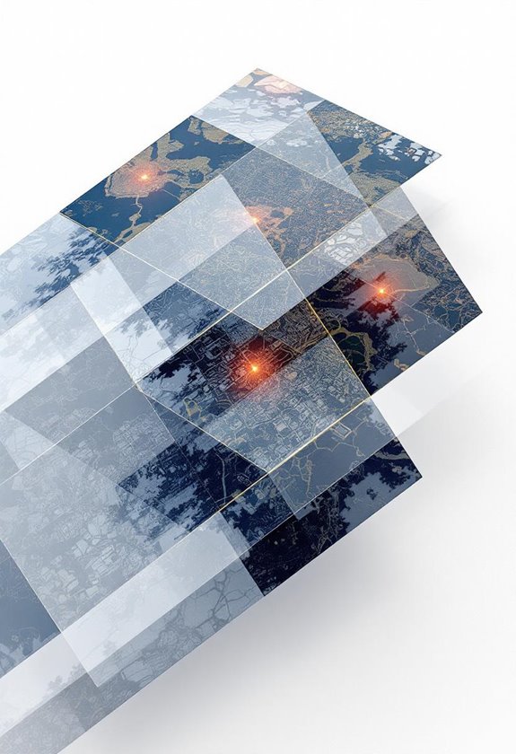
For instance, in open spaces, a drone can link up with 14 to 18 satellites, meaning it could position itself within just 1-2 meters of accuracy. That’s why you can see drones hovering steadily, even when the wind is blowing. It’s pretty cool to think about how technology, like GPS, GLONASS, Galileo, and BeiDou, all work together to make this happen! So, whether you’re flying a drone for fun or for a project, understanding this can really enhance your flying experience. Speaking of which, let’s chat about how these drones actually control their flight paths next!
Many drones also use optical flow positioning to stabilize their flight when satellite signals are weak or unavailable.
Understanding Triangulation and Its Importance for Drones
Hey, have you ever thought about how drones figure out where they are up in the sky? It’s all thanks to a method called triangulation! Essentially, drones rely on signals from at least three satellites. By measuring how long it takes those signals to reach the drone, they can determine the exact distance to each satellite.
Now, to get super accurate positioning, drones usually connect with at least four satellites. This extra satellite helps to correct any hiccups or mistakes that might pop up during the calculations. For instance, when you’re flying your drone in a way that might block signals—like behind a tall building—having those extra satellites makes sure you still get a precise location.
Many drones tap into multiple satellite systems, like GPS and GLONASS, to boost their triangulation accuracy. This means they can maintain a steady hover and follow precise flight paths. Think about it: when you’re capturing video or photos from the air, that accuracy is crucial for getting those breathtaking shots. It’s amazing how such technology lets us capture stunning images from the skies! So, next time you see a drone in action, you’ll know just how smartly it’s navigating its way around. Effective obstacle avoidance also relies heavily on accurate positioning to ensure safe flight paths.
What’s the Difference Between GPS and GNSS?
Hey there! So, when we chat about satellite navigation, “GPS” is usually the word that pops up, right? But here’s the thing: GPS is just one piece of a much bigger puzzle called GNSS, or Global Navigation Satellite System. Think of GPS as a specific brand of coffee, while GNSS is more like a rich coffee blend with flavors from all over the world. GPS, run by the United States, only taps into its own set of satellites. In contrast, GNSS brings together systems like Russia’s GLONASS, Europe’s Galileo, and China’s BeiDou.
What does that mean for you? Well, using GNSS means you can grab signals from lots of satellites at once—often ten or more! This is super handy, especially in busy cities or tight spaces where buildings can block signals. For instance, if you’re trying to find your way in a crowded downtown area, a GNSS device is way more reliable than a standalone GPS unit. Plus, there are cool technologies out there, like Real-Time Kinematic (RTK) positioning, that can get you accuracy within a couple of centimeters. Imagine using that for things like precision farming or surveying land! Reliable devices often incorporate high accuracy ratings to ensure precise measurement in navigation systems.
Essential GNSS Systems for Drones
Hey there! Have you ever thought about how essential GNSS systems are for camera drones? They play a huge role in helping these drones navigate and find their way around, making everything more efficient. Drones typically use systems like GPS, GLONASS, Galileo, and BeiDou to pinpoint their location accurately. It’s pretty cool that having around 10 to 12 satellites in sight can make a real difference in positioning accuracy.
These GNSS systems allow drones to perform some neat automated features. For instance, when a drone is low on battery, it can execute a Return-to-Home (RTH) function, safely guiding itself back to where it took off. This is super important for both safety and smooth operation. If you think about precision agriculture, having a reliable navigation system means farmers can monitor their fields more effectively—imagine drones mapping out crop conditions with pinpoint accuracy.
And speaking of accuracy, let’s not forget about RTK GNSS technology. This can help achieve centimeter-level precision, which is fantastic for aerial photogrammetry tasks. It really minimizes drift, making each flight dependable, even in tricky environments. This brings us to the next point—choosing the right drone for your specific needs can make all the difference! Drones equipped with advanced 3-axis gimbal systems also help maintain stability during flight, ensuring clearer and sharper images.
How GNSS Enhances Stability and Control in Drones
Hey, have you ever wondered how GNSS enhances stability and control in drones? It’s pretty fascinating! By using signals from at least six satellites—though having around ten to twelve is even better—GNSS ensures that drones experience minimal horizontal drift. This is super important for activities like aerial photography. Imagine trying to capture that perfect sunset shot while the drone is bobbing around in the wind; it’s not easy!
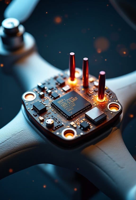
Take the Potensic ATOM series, for example. It combines GNSS data with additional sensors, which helps keep the drone steady by adjusting for any unexpected movements. In wide-open spaces, if you connect to about 14 to 18 satellites, you can achieve centimeter-level accuracy. This means drones can navigate precisely and stick to their flight paths, even when handling complex tasks, making everything more dependable. To maintain this precision, it is crucial that drones are carried safely in backpacks with adequate protection features designed to prevent damage to sensitive GNSS equipment.
Open vs. Obstructed Environments: GNSS Accuracy Effects
Hey there! Let’s chat about how GNSS accuracy—essential for flying camera drones—changes depending on where you’re flying. When you’re in an open space, you’re usually looking at an impressive accuracy of about 1-2 meters. This is because you have a clear view of the sky and can connect to a bunch of satellites—usually around 14 to 18 of them! It’s like having a solid GPS signal that really guides you well.
Now, picture this: if you’re flying in a downtown area surrounded by tall buildings or thick tree cover, things get trickier. The signals from satellites can get blocked, and you might lose connection to most of them, sometimes dropping down to less than six satellites! That’s when your drone’s position can start to drift, which is not what you want when you’re trying to capture that perfect shot or keep it steady.
To keep your drone flying smoothly, try to find spots where you have at least some clear sky overhead, even in crowded places. Sometimes, just shifting a few feet can make a huge difference in your satellite signal. So, always be on the lookout for those openings above you—they’re crucial for reliable drone operation! Plus, staying aware of your environment can help you plan better for your photography adventures.
Additionally, drones equipped with GPS systems with auto-return functionality can enhance safety by preventing fly-aways if satellite signals weaken.
Advanced GNSS Tech Enhancing Precision in Drones
You know, when we fly our camera drones to capture those stunning aerial shots, we often overlook the incredible advancements in GNSS technology that make it all happen. This tech is really changing the game for how we get precise results in aerial photography and mapping. Take Real-Time Kinematic (RTK) systems, for example—they can provide accuracy down to just a few centimeters. That level of detail is super important if you’re doing something like land surveying where every inch counts.
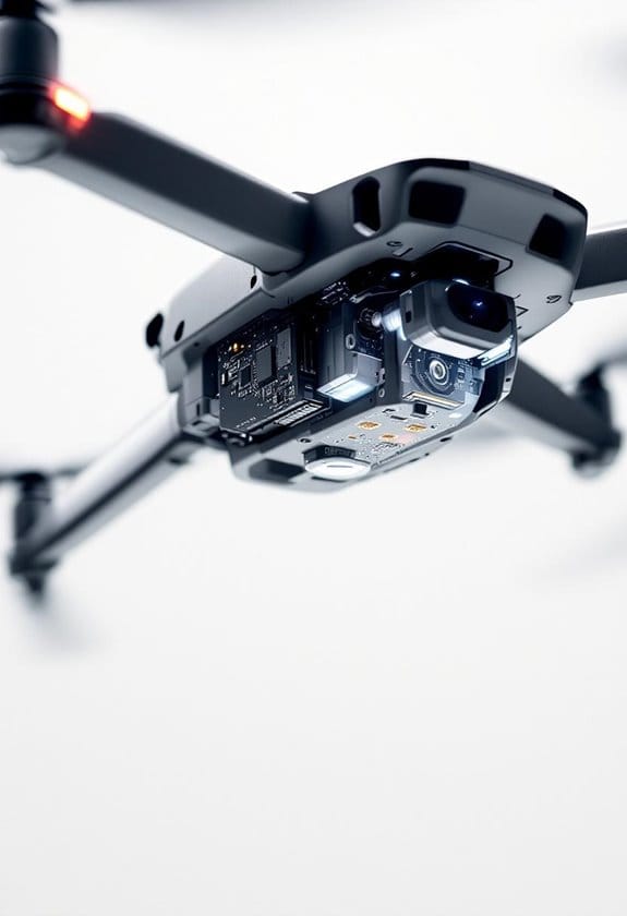
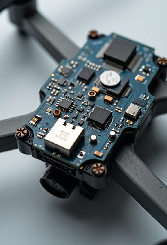
Now, let’s talk about multi-constellation GNSS receivers. These clever devices can pick up signals from different satellite systems like GPS, GLONASS, Galileo, and BeiDou, which means they can still work well in tricky spots where the signal might get blocked, like between tall buildings. Plus, smart GNSS antennas combine both the receiver and antenna technology, saving power while giving you the best performance for your drone.
And here’s a cool detail: there are antenna designs that resist interference, ensuring you get a solid signal even in urban areas. This is crucial because the last thing you want is your drone losing signal just when you need it most. One neat tech advancement is beamforming. It helps your drone focus on the strongest signals around, making navigation even more precise. So, next time you’re out flying your drone, remember—there’s a lot of brilliant tech making those stunning landscapes easier to capture. It’s a great time to explore the skies! Additionally, maintaining optimal drone performance is closely linked to using intelligent flight batteries that ensure smooth navigation and prolonged flight times.
How GNSS Improves Drone Safety and Usability
Hey there! You know how drone flying can sometimes feel a bit nerve-wracking? Well, that’s where GNSS technology comes in—it really upgrades both safety and usability. With GNSS, our drones can hover steadily in one spot, even if the wind tries to push them around. This steady hovering makes a big difference for capturing beautiful images since the shots turn out much clearer.
One of my favorite features that rely on GNSS is the Return-to-Home function. If your drone is about to run out of battery or if it loses signal, it can automatically find its way back to where you launched it from. It’s like having a safety net! Just imagine you’re at a park, and your drone signals a low battery. Thanks to GNSS, you don’t have to panic; it knows how to get home safely.
For more precise flying, like when you’re shooting a film, GNSS needs signals from at least six satellites to do its job well. But the real magic happens when it connects to 10 or 12 satellites, giving you much better positional accuracy. And if you’re thinking about indoor flying, combining GNSS with visual positioning systems makes navigating inside a breeze. You can capture those perfect indoor shots without a hitch!
Additionally, just like a high-quality UV protection filter safeguards camera lenses to preserve image clarity, GNSS helps maintain drone stability for sharper images and safer flights.
Future Trends in GNSS Development for Drone Applications
Hey there! You know how drones are becoming more and more popular these days? Well, the future of GNSS development for drone applications is shaping up to be pretty exciting. For starters, smart GNSS antennas are making their way into these flying machines. Imagine antennas and receivers combined into one compact unit—this helps make drones lighter and gives them better performance.
And let’s talk about MIMO antennas. These clever designs can help reduce interference, which is super important for drones that are flying around together. By using multiple signals at once, they can communicate more accurately and avoid losing their way. Also, beamforming technology is on the rise, which means drones can pinpoint the most reliable GNSS signals available, helping them navigate through challenging places like urban environments with tall buildings.
Another cool development is multiband GNSS antennas that can receive signals from different satellite systems at the same time. This boosts reliability significantly. Plus, researchers are hard at work strengthening anti-jamming solutions, which ensures that drones can stay on track even in tough scenarios where signal disruption might happen.
With all these innovations coming together, drones are becoming smarter and more capable of tackling a variety of tasks. Furthermore, integrating user-friendly controls enhances overall drone operation, making them easier to pilot even in complex environments.
It’s definitely a thrilling time for drone enthusiasts and those involved in using them for different applications!
Frequently Asked Questions
How Does GPS Affect Battery Life in Camera Drones?
As we soar through breathtaking skies, GPS battery optimization plays a vital role. Effective drone energy management helps reduce GNSS power consumption, ensuring longer flights and more time capturing stunning aerial moments together.
Can GPS Signals Be Jammed or Interfered With?
Yes, GPS signals can be jammed or interfered with. We should be aware of various GPS jamming techniques and signal interference sources, as the impact of jamming can seriously disrupt our drone operations and accuracy.
What Happens if a Drone Loses GPS Signal Mid-Flight?
If our drone loses GPS mid-flight, we might panic, but there are signal recovery strategies. Understanding drone malfunction risks, we follow emergency landing procedures to guarantee a safe, albeit dramatic, descent back to Earth.
Are There Alternative Navigation Systems for Drones Without GPS?
Yes, there’re alternative navigation systems for drones without GPS. We can use visual odometry, inertial navigation, and computer vision technologies to guarantee safe and reliable flight, even when GPS signals are unavailable.
How Accurate Is GPS in Urban Environments for Drones?
In urban environments, GPS accuracy can drop to within 10 meters due to signal issues. We face significant positioning challenges and interference sources from buildings, making reliable navigation tricky for our drones in bustling cities.