As an Amazon Associate, we earn from qualifying purchases. Some links on this site are affiliate links at no extra cost to you. Our recommendations are based on thorough research and editorial judgment.

Understanding Ground Control Points in Drone Mapping
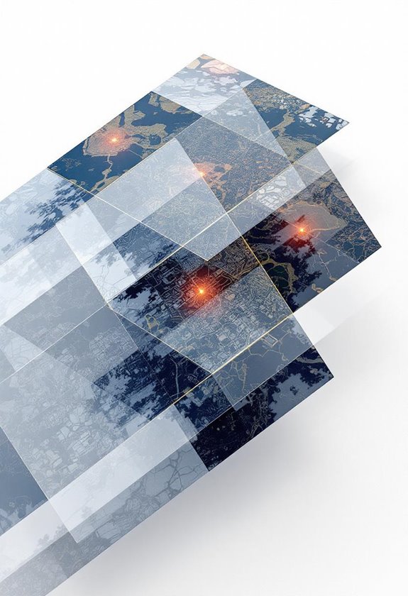
Ground Control Points (GCPs) are vital in drone mapping because they provide precise geographic coordinates and greatly enhance measurement accuracy, from meters down to centimeters. To achieve this, we should use at least four GCPs, ideally more for larger areas, and place them carefully, avoiding obstructions like trees or buildings. Employing effective types, such as checkerboard squares or orange X shapes, can improve visibility. By understanding GCPs, we can guarantee high-quality mapping results that are critical for many applications. As we move forward, we’ll explore more about their setup and techniques for successful implementation.
Key Takeaways
- Ground Control Points (GCPs) enhance mapping accuracy, reducing measurement errors from meters to centimeters through precise geographic coordinates.
- A minimum of four GCPs is recommended for reliable results, with eight preferred for larger areas.
- GCPs should be placed in a balanced distribution, avoiding clustering and obstructions for optimal GNSS readings and data integrity.
- Utilizing advanced GNSS technology like RTK or PPK ensures centimeter-level accuracy in GCP measurements, enhancing overall mapping quality.
- Drones paired with GCPs facilitate efficient, cost-effective data collection, allowing for quick analysis and improved geographic data reliability.
Why Ground Control Points Matter in Drone Mapping

You know, when it comes to drone mapping, Ground Control Points (GCPs) really matter. They’re like reference points on the ground that give us precise geographic coordinates, making our maps much more accurate. Instead of a few meters off, we can get our measurements down to just a few centimeters!
Using at least four GCPs is a good start, but if we’re covering a larger area, aiming for eight is even better. This ensures that we’re aligning what we see on the drone images with the actual locations on the ground—think of it as making sure a photograph matches the scene in real life. This is incredibly important for things like legal surveys, where accuracy is key, or infrastructure inspections, where we need to analyze structures carefully.
Another cool thing about GCPs is how they help prevent distortion during the georeferencing process. Think of it this way: when we place them strategically, we create reliable point clouds that give us clear views of changes over time. So, whether we’re tracking land development or monitoring environmental changes, GCPs are essential for delivering high-quality data. They really set the stage for what we can achieve with our drone surveys.
Using high-quality and durable materials for equipment ensures reliable operation during data collection and helps maintain accuracy in measurements.
Recommended Products

WORKS WITH LEADING PHOTOGRAMMETRY SOFTWARE - Pix4D, DroneDeploy, Metashape, OpenDroneMap/WebODM, UAV4GEO Lightning, DJI Terra, Esri Drone2Map, Bentley ContextCapture, SimActive Correlator3D, 3Dsurvey, Propeller, Global Mapper Pro & RealityCapture

【BLACK WHITE】Our GCPs are in black and white with strong color contrast to provide optimal visibility in bright conditions. Using our GCPs allows you to capture accurate data more accurately.

Set Includes: this set includes 10 ground control points labeled 0–9 for quick coordinate matching, a storage bag for easy portability and organization, and 50 metal stakes for secure placement; The pre-punched holes at each corner allow the markers to be firmly anchored, reducing movement in windy conditions and helping to maintain accuracy during aerial mapping
Types of Effective Ground Control Points You Should Use

When it comes to drone mapping, choosing the right ground control points (GCPs) is more than just a technical decision—it’s crucial for getting accurate results. Effective GCP types include checkerboard squares, orange X shapes, and black squared markers. These designs stand out in aerial images, making them easy to spot even from above.
You want your GCPs to be around 0.5m x 0.5m (that’s about 2ft x 2ft) and use high-contrast colors. This helps prevent glare and ensures they are visible in various lighting conditions. For example, if you’re mapping a large field, opting for bright orange Xs can help a lot because they pop against the greenery.
To achieve good accuracy, it’s best to use at least four GCPs, but I recommend aiming for eight if you’re covering an area up to 50 acres. If your project spans a larger area or has uneven terrain, adding an extra 10-20% more GCPs can really help keep everything precise. So, as you plan your next drone mission, think about how many GCPs you’ll need to lay a solid foundation for your mapping project. This sets you up for success as you move on to the next stages of data collection! Utilizing drones equipped with advanced sensors can further enhance the precision of your mapping data.
Recommended Products

Enhanced Field Coordination: These UAV aerial drone center eyelets numbered survey markers enable effortless identification and precise coordinate tracking, streamlining your operations in the field. Easily locate and reference specific points during mapping missions.

WORKS WITH LEADING PHOTOGRAMMETRY SOFTWARE - Pix4D, DroneDeploy, Metashape, OpenDroneMap/WebODM, UAV4GEO Lightning, DJI Terra, Esri Drone2Map, Bentley ContextCapture, SimActive Correlator3D, 3Dsurvey, Propeller, Global Mapper Pro & RealityCapture
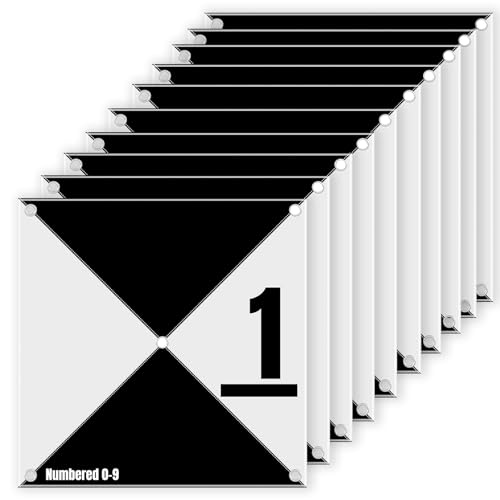
【BLACK WHITE】Our GCPs are in black and white with strong color contrast to provide optimal visibility in bright conditions. Using our GCPs allows you to capture accurate data more accurately.
Setting Up Ground Control Points Effectively

Setting up ground control points is super important for getting precise results in drone mapping projects. If you’re like most folks, you want your maps to be as accurate as possible, right? Start by planting at least five Ground Control Points (GCPs) throughout your survey area. Ideally, place one GCP in each corner and one right in the center. Just make sure that no two GCPs are more than 400 meters apart so you can keep your positioning on point.
A neat tip for laying out your GCPs is to use a zigzag pattern. This way, you avoid clustering them together, which can lead to errors. Also, keep your GCPs away from any buildings or trees. Clear lines of sight help ensure your GNSS readings are spot on! And if your survey area has different types of terrain, adding an extra 10-20% more GCPs can really help maintain reliable data. Using high-quality materials for markers can improve durability and readability throughout the survey process.
Recommended Products

【BLACK WHITE】Our GCPs are in black and white with strong color contrast to provide optimal visibility in bright conditions. Using our GCPs allows you to capture accurate data more accurately.

Precise Dimension Design: the internal space of the storage bag is precisely tailored to fit 24 x 24 inch drone ground control point (GCP); With ample reserved space inside, it can hold 10 GCPs at once, meeting the full carrying needs for a single outdoor surveying and mapping operation

【ECONOMICAL】Made from hard paper, the 100-count pack offers a low cost per unit and is a great alternative to many DIY solutions commonly used in the industry.
Understanding the Importance of Ground Control Points in Drone Surveying
When it comes to drone surveying, having accurate measurements is crucial, and that’s where Ground Control Points, or GCPs, come in. Essentially, GCPs act like anchors for our aerial maps by providing known coordinates, which helps us achieve the level of accuracy that’s necessary for different mapping projects. Ideally, we should set up at least four GCPs, but eight is better for larger areas—we’re talking about transforming measurement errors from potentially meters down to just centimeters.
Placing these points correctly and spreading them out well is really important because it helps prevent distortion and gives us more reliable data. For example, in legal surveys or infrastructure inspections, using GCPs can save lots of headaches and disputes down the line. In fact, a study found that when GCPs were included, horizontal mapping errors were reduced from 12 centimeters to only 2 centimeters! This shows just how vital GCPs are for getting the precision we rely on. To further enhance accuracy and efficiency in surveying, many operators integrate drones equipped with GPS functionality that enables precise navigation and mapping capabilities.
Top Techniques for Accurate Measurement and Verification of Ground Control Points
You know, when it comes to mapping projects, making sure we have reliable Ground Control Points (GCPs) is super important. Using GNSS receivers with RTK or PPK technology can really boost our accuracy to within centimeters! For instance, if you’re mapping a large park, setting up these receivers can help you pinpoint features like walking paths and trees with precision.
It’s also a good idea to take multiple measurements at different times. Doing this not only ensures high precision but also acts like a safety net to catch any mistakes. Plus, while you’re measuring, keep a clear line-of-sight to each GCP. If there are trees or buildings blocking your view, it could mess with your data.
Another tip? Spread out your GCPs rather than clustering them in one spot. For example, if you’re working on a neighborhood mapping project, placing GCPs at key intersections will give you better overall accuracy. And don’t forget, taking photos of each GCP not only helps you remember where they are but also serves as a useful reference down the line to confirm what you collected.
For enhanced data collection, pairing ground measurements with thermal imaging cameras aboard drones can provide valuable additional insight.
Recommended Products

1. Unique DIY Drone:This DIY drone integrates optical flow positioning modules, video modules, and high-power brushless motors.The assembly process takes approximately 1.5 hours and requires patience and hands-on skills. Recommended for users aged 14 and above. Difficulty level: 5/5.

𝐘𝐨𝐮𝐫 𝟏𝐬𝐭 𝐃𝐈𝐘 𝐃𝐫𝐨𝐧𝐞 - F450 is the best DIY drone for both beginners to learn the basics and experts to conduct research or secondary development.

✅ Real-Time RI Drone Detection: Instantly detects drones using remote ID radio frequency (RI) signals – even when drones aren’t visible
Addressing Common Challenges With Ground Control Points
Hey there! You know how important Ground Control Points (GCPs) are for getting those precise measurements in aerial mapping projects, right? Well, while they’re crucial for accuracy, they can also create some hurdles if we’re not careful about how we set them up.
First off, it’s super important to think about where we place these GCPs. If we bunch them together in one spot, it can actually mess with the data we collect. Imagine setting up several markers right next to each other; you might end up missing important details in other areas. So, spreading them out strategically across the entire survey site is key. Also, be sure to pick spots where the markers are easy to see—avoid locations that have trees or buildings nearby that could obstruct GPS signals.
And let’s not forget about the terrain! If you’re surveying an area with hilly or uneven ground, those elevation changes can create what’s known as “air pockets” in the data. Instead of just adding more GCPs, aim for a balanced distribution across the landscape—this will help ensure that the results are as accurate as possible. By paying attention to these details, we can really improve our aerial mapping efforts and get the best possible data. It’s all about being strategic and aware of the environment! Using drones equipped with intelligent GPS features can also enhance the accuracy and reliability of the data collected at each GCP.
Recommended Products

16"x16" size easily visible in drone photographs up to 400' above ground Biodegradeable materials means you don't have to pick up your GCPs after a project Pink & green color...
Frequently Asked Questions
How Many GCPS Do I Need for Accurate Mapping?
How can we determine the right number of GCPs? GCP density considerations and terrain variations influence our choices, balancing survey precision requirements with project scale impacts, while factoring in time, resource constraints, and software processing effects.
Can I Use Virtual GCPS Instead of Physical Ones?
Yes, we can use virtual GCPs for drone mapping. They offer cost-effective solutions while improving precision. However, we should consider GCP accuracy comparison, software integration, and calibration techniques to meet mapping standards. User experiences vary.
What Materials Are Suitable for Creating GCP Markers?
For GCP markers, we recommend durable materials like surveying stakes and ground stakes. Using reflective tape and colored flags improves visibility, while marking paint and waterproof markers guarantee longevity. Proper GCP spacing is also essential for accuracy.
How Do Environmental Conditions Affect GCP Accuracy?
Environmental conditions can greatly impact GCP accuracy, like how a storm clouds a sunny day. Weather impacts, lighting conditions, temperature variations, and vegetation interference can all hinder aerial visibility, affecting our drone mapping efforts.
Is GPS Accuracy Sufficient for Placing GCPS?
GPS accuracy isn’t always sufficient for placing GCPs due to GPS limitations. We should consider GCP methods, equipment calibration, and surveying techniques to overcome accuracy challenges, ensuring drone precision meets mapping standards with GNSS technology and effective data processing.