As an Amazon Associate, we earn from qualifying purchases. Some links on this site are affiliate links at no extra cost to you. Our recommendations are based on thorough research and editorial judgment.
Using Aerial Imaging for Agriculture and Crop Monitoring
Using aerial imaging in agriculture allows us to monitor crop health with precision and efficiency. Drones and satellites provide valuable insights, like identifying stressed areas through NDVI analysis. We can detect diseases and pests early, assess soil moisture using thermal imaging, and create detailed maps for informed decision-making. While there are challenges, such as weather and costs, the benefits far outweigh them. Stick around, and you’ll discover more about future trends and sustainable practices in this field.
Key Takeaways
- Aerial imaging employs drones and satellites, enhancing crop monitoring and identifying issues through NDVI technology.
- Timely detection of crop stress allows for faster interventions, preventing larger problems and boosting yields.
- Multispectral and thermal cameras provide accurate assessments of plant health and soil moisture levels for efficient irrigation.
- AI analyzes aerial data, enabling farmers to focus on specific trouble areas and make informed decisions promptly.
- Cloud computing enhances accessibility to data, facilitating real-time insights and smart, collaborative resource management in agriculture.
Transforming Agricultural Practices With Aerial Imaging

Have you ever thought about how aerial imaging is changing the farming game? It’s truly fascinating! With the help of drones and satellites, farmers can now monitor their crops like never before. Imagine being able to quickly spot areas where crops might be struggling—this is all thanks to a tool called NDVI, or Normalized Difference Vegetation Index. It works by analyzing the difference between how healthy plants look in infrared light compared to regular light. So, if a farming area shows signs of stress, farmers can jump in and address the issue faster.
But that’s not all! Farmers are also using aerial images for soil analysis and creating detailed maps of their land. For instance, if a drone captures images of uneven terrain, farmers can adjust their irrigation systems to ensure water reaches every plant evenly. This kind of precision helps them conserve resources and improve their yields. It’s all about making smarter choices based on real data. Additionally, drones equipped with advanced thermal imaging allow for even more detailed crop health assessments to optimize farming practices.
Innovative Technologies Powering Aerial Imaging in Agriculture

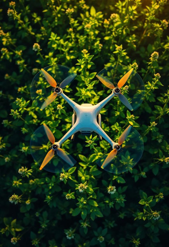
Hey there! Have you ever thought about how aerial imaging is changing farming? It’s pretty fascinating! Drones these days come loaded with multispectral and thermal cameras that let farmers keep a close eye on their crops. For example, by flying over fields, they can spot areas where plants might be struggling due to stress or not getting enough water.
What’s even cooler is how artificial intelligence comes into play. After the drones capture those images, AI can analyze the data, showing farmers exactly where to focus their attention. This means they can tackle issues like pests or nutrient deficiencies quickly before they get worse. Plus, with cloud computing, all the information is stored securely and can be accessed whenever needed, making it easy to manage.
And let’s not forget photogrammetry! This technique allows farmers to create detailed 3D maps of their fields. These maps help in understanding the layout and terrain better, which is super useful for making decisions about irrigation or planting patterns. It’s clear that with all these technologies combined, farming is becoming smarter and more efficient every day! Additionally, the high-quality 12MP NDVI camera drones enable precise monitoring and assessment of plant health for better crop management.
Recommended Products

【US Local Service Support Team】: ①If you damaged your drone, we always offer low-cost replacement parts in our store & Local warehouse ②We keep upgrading the APP and Tablet system for more Features, KEEP AWAY FROM TREES FOR DRONE SAFETY! AVOID CRASHING TREES. ③Bingchat offers one year quality free replacement support along with 3 years flight quality support. ④Based on our trusted after-sale support, our awesome drones have a high repurchase rate and referral rate from our customers

✅ Made for First-Time Flyers – Professional Results: EZ Pro makes flying easy even if you’ve never touched a drone. With AI-assisted flight and auto-stabilization, you’ll capture stunning aerial shots with zero stress.
Top Uses of Aerial Imaging in Crop Monitoring

Hey! You know, crop monitoring has really taken off with the rise of aerial imaging techniques. These tools let farmers keep a close eye on how their crops are doing from above, which means they get instant alerts for problems like diseases or pests. For example, with NDVI, which stands for Normalized Difference Vegetation Index, farmers can see how stressed their plants are just by looking at colorful aerial photos.
Then there’s thermal imaging, which helps determine moisture levels in the soil. Imagine being able to see exactly where your crops need water—it’s a total time-saver and makes sure every drop counts.
And don’t forget about aerial photography; it’s super helpful for getting accurate counts of how many plants are actually growing and even mapping out the land’s shape. This way, farmers can tailor their care to specific areas rather than using a one-size-fits-all approach. Using drones equipped with high-resolution cameras can further enhance the detail and accuracy of crop monitoring data.
Recommended Products

Unlock Adrenaline-Pumping Immersive Flying - Prompt visual feedback through goggles as if you were right there in the cockpit, enjoying a breathtaking perspective, pure thrill and total freedom.

Experience the Thrill of Flying: Enjoy total immersion and intuitive control with DJI Avata. When you combine Avata with the goggles and motion controller, flight becomes accessible to all.

Lightweight and Regulation Friendly - At just 135g, DJI Neo may be even lighter than your phone and does not require FAA registration and Remote ID. Throw Neo in your backpack or even your pocket. Just grab and go!
Benefits of Using Aerial Imaging for Precision Agriculture
Hey there! Have you ever thought about how aerial imaging can transform farming? In the world of precision agriculture, using tools like drone imagery really changes the game for farmers. With aerial imaging, they can easily track crop health by using something called the Normalized Difference Vegetation Index, or NDVI for short. This tool helps to spot areas where plants might be struggling, like when they need more water.
For example, imagine a farmer who notices a patch of corn looks a little droopy through the drone’s lenses. With this early detection, they can quickly address the water issue before it impacts the entire field. And that’s just the beginning! By counting plants from above, farmers can create detailed maps of their fields. This helps them decide where to replant for better yields.
Plus, constant monitoring means farmers can scout their fields more efficiently. Instead of walking through every inch of land, they can focus on specific trouble spots, saving time and labor costs. When you add satellite imagery and some smart technology, farmers can even predict crop losses and get a solid idea of their potential harvest. It’s pretty fascinating how aerial imaging fits into modern farming, isn’t it? Now, let’s explore how these insights can help with sustainable practices. Thermal camera drones with high-resolution imaging enhance precision by detecting subtle temperature variations in crops and soil.
Addressing Challenges of Aerial Imaging in Agriculture
You know, aerial imaging is such an exciting tool for farmers. It really has the potential to change how we approach agriculture. However, there are some challenges we need to consider. For instance, weather plays a big role—like when there’s cloud cover, it can seriously affect the quality of the data we get from aerial imaging. This means farmers might not be able to monitor their crops as often as they’d like.
Then there’s the issue of drones themselves. They can be quite complex to operate, which often means you need a fair bit of training. Plus, purchasing them can require a hefty investment, making it tough for smaller farms to get their hands on this technology. For example, a small farmer might want to use drone imagery to monitor crop health, but without access to the necessary equipment or expertise, they miss out on crucial insights.
Also, seasonal changes present their own set of hurdles. Take winter, for instance; the cold can limit drone effectiveness since many imaging systems don’t work well in low temperatures. And let’s not forget about the red tape—zoning laws and FAA regulations can put a damper on where and how often drones can be flown, further complicating things for farmers looking to use aerial imaging. Additionally, protecting sensitive equipment with waterproof and durable materials can be critical to ensuring consistent operation in challenging outdoor environments. Overall, while the promise of these tools is huge, there are still a few hurdles to jump over. Now, let’s take a closer look at how some farmers are working through these challenges…
Recommended Products

True 360° Immersive Flight: Experience the Vision Goggles' massive 90° FOV, 66% wider than standard goggles*, with dual 1-inch Micro-OLEDs and Pancake optics that deliver uncompromised immersion. Its lightweight, 340g design with built-in diopter adjustment ensures a sharp, glasses-free view for every pilot.

DVR Mavic Air (arctic white)

【Impressive 10000FT Long Range & 5G FPV Transmission】: Control this GPS drone from up to 10000 feet away with crystal-clear 5G real-time FPV feed on the 4.5" HD screen remote – great for exploring vast areas while seeing exactly what the drone with camera sees.
Future Trends in Aerial Imaging for Sustainable Farming
Hey there! Have you ever thought about how aerial imaging is shaping the future of sustainable farming? It’s pretty exciting! With technology like drones and thermal imaging, farmers can keep a close eye on their crops’ health and manage water use more efficiently. For example, drones equipped with NDVI sensors can quickly show areas that might need more water or nutrients, allowing farmers to act right away instead of waiting to notice problems in the field.
One big trend we’re seeing is the use of machine learning. This means farmers can get more accurate predictions about crop yields and potential losses, which is really empowering. Imagine being able to forecast your harvest more accurately and plan accordingly—that can make a huge difference in both productivity and profits!
We’re also looking at better ways to manage all this data. With advancements in cloud computing, farmers can access real-time insights on their crops, making it easier to make smart, data-driven decisions. For instance, if a farmer notices a specific area of their field needs attention, they can address it immediately rather than waiting for a scheduled inspection.
Collaboration is another key piece of the puzzle. By teaming up with agronomists and tech experts, farmers can fully utilize the potential of aerial imaging. This teamwork not only improves how we understand farming but also promotes resource efficiency, which is crucial for sustainability. And when farmers manage water wisely, they contribute to both their bottom line and the health of the planet.
It’s amazing to see how these innovations will transform agriculture. The integration of ground control points in drone mapping helps improve crop monitoring accuracy by ensuring precise geo-referencing for better data analysis. But there’s so much more to explore about how technology is impacting farming practices!
Frequently Asked Questions
What Are Aerial Images Used for in Agriculture?
We use aerial images for crop health assessment, pest detection, and yield prediction. They enhance monitoring efficiency, support irrigation management and soil assessment, and streamline farm planning with precise data for improved agricultural practices.
Which AI Tool Is Best for Agriculture?
When we envision a thriving farm, we think of IBM Watson for precision farming, helping with crop health, yield prediction, pest detection, and irrigation management. It’s like having a weathered guide by our side through agriculture’s challenges.
How Are Drones Used in Crop Monitoring and Management?
We use drone technology for crop monitoring by evaluating crop health, performing yield estimation, and conducting field mapping. It’s also invaluable for pest detection, irrigation management, and soil analysis, enhancing precision agriculture practices considerably.
How Much Does Aerial Crop Imaging Cost?
Aerial imaging pricing varies considerable; we’ve found costs between $5 to $50 per acre. For effective crop health assessment, understanding operational costs, seasonal variations, and spatial resolution in comparison studies helps optimize our investment in data analysis software.


