As an Amazon Associate, we earn from qualifying purchases. Some links on this site are affiliate links at no extra cost to you. Our recommendations are based on thorough research and editorial judgment.

Capturing Coastal Erosion and Geological Changes With Drones
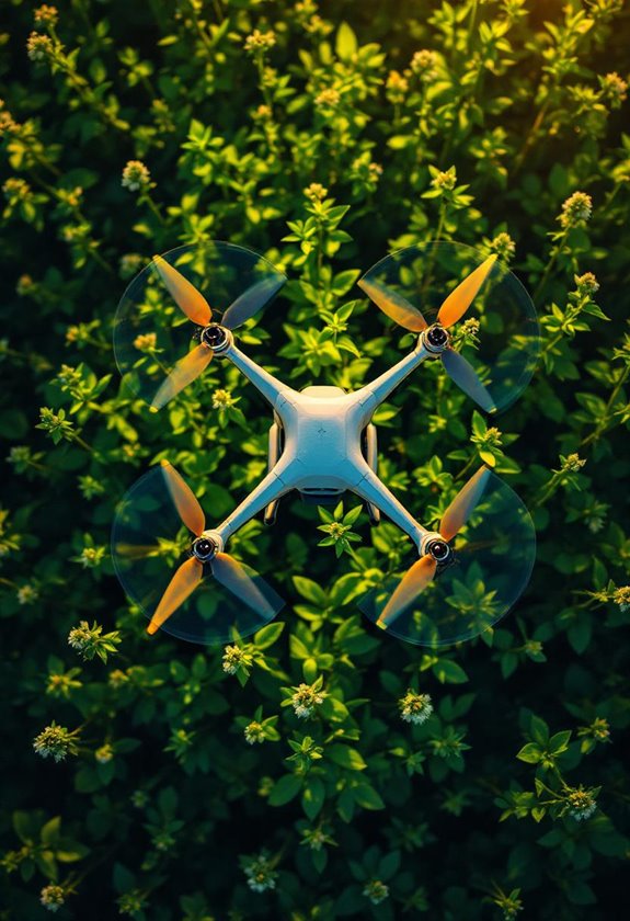
We harness drone technology to effectively capture and monitor coastal erosion and geological changes along shorelines. Drones provide high-resolution images and real-time data, helping us detect minor shifts and assess damage after storms. They facilitate access to remote areas, improving efficiency in monitoring. Key features, like LiDAR and multispectral sensors, enhance our understanding of coastal dynamics. By integrating this data with GIS, we gain insights into erosion trends, paving the way for effective conservation strategies—there’s more to uncover about their benefits and challenges.
Key Takeaways
- Drones equipped with high-resolution cameras and sensors capture detailed images of shorelines, highlighting changes in coastal erosion and geological features.
- Digital Elevation Models (DEMs) created by drone data visualize sediment shifts and help assess past and future coastal changes.
- Continuous monitoring through drone surveys enables detection of even minor shifts in coastal landscapes, facilitating timely responses to erosion.
- Advanced tools like LiDAR and multispectral sensors enhance data accuracy and provide insights into ecological changes related to coastal erosion.
- Integration of GIS and machine learning algorithms enables efficient data analysis, improving predictive modeling for future erosion impacts.
The Impact of Coastal Erosion on Ecosystems and Communities

Hey there! Have you ever thought about how coastal erosion impacts both the ecosystems and the communities that rely on our beautiful shorelines? It’s a pretty big deal. With rising sea levels and stronger storms thanks to climate change, we’re seeing habitats shrink for all kinds of wildlife, and that’s disrupting their breeding and feeding patterns. For instance, sea turtles that rely on sandy beaches to nest are losing those critical spots due to erosion, which can really harm their populations.
Now, communities near the coast often depend on these areas for tourism and recreation. When the shoreline erodes, these places can face tough economic challenges, like the increasing costs of repairing piers or buildings damaged by storms. And then there’s the issue of saltwater making its way into freshwater supplies — this can be a major problem for people who need clean water for drinking and growing crops.
That’s why keeping an eye on coastal erosion is so important. By monitoring these changes, we can better understand what’s happening and figure out ways to protect both the natural habitats and the people who live nearby. It’s all about finding that balance between nature and community needs. Speaking of which, using advanced technology like drones equipped with D-Log camera systems allows for detailed and high-quality monitoring of these changes to support effective management strategies.
Let’s explore some effective strategies for managing coastal erosion!
How Drones Help Us Monitor Coastal Changes
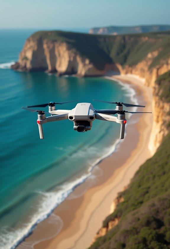
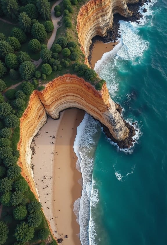
Have you ever thought about how drones are helping us keep an eye on coastal changes? It’s pretty fascinating! These little flying machines are changing the way we monitor things like coastal erosion. With high-resolution cameras and advanced sensors, drones take incredibly detailed photos of shorelines. For instance, they can create Digital Elevation Models (DEMs) which help us visualize changes in coastal slopes and landscapes over time.
By using drones to continuously collect data, scientists can spot even the tiniest shifts in the coastline. For example, after a storm, researchers can quickly assess how much sand has moved along the beach or if any cliffs have eroded. This kind of immediate feedback is crucial for understanding erosion trends and planning effective management strategies. The integration of infrared thermal imaging significantly enhances the ability to detect subtle temperature variations associated with geological changes.
Benefits of Drones in Coastal Erosion Monitoring
Have you ever thought about how drones play a crucial role in monitoring coastal erosion? They’re actually a fantastic resource for understanding how shorelines change over time. For example, these small flying machines are equipped with high-resolution cameras that take clear pictures, allowing us to see even tiny shifts in the shape of the shoreline.
One of the coolest things about drones is how quickly they can gather data. They create detailed maps and elevation models that help scientists assess erosion more accurately. Plus, they can reach tricky spots that are hard for people to get to, no matter the weather. This means we get reliable data consistently, which is essential for tracking how our beaches are evolving.
Regular drone surveys help us keep an eye on beach erosion trends, so we can make informed decisions about coastal management. By combining the information we gather from drones with geographic information systems (GIS), we can predict how shorelines might change as sea levels rise. It’s all about making smarter choices to protect our coastlines for the future.
Thermal imaging capabilities on drones further enhance monitoring by detecting subtle temperature variations in coastal environments, offering an additional layer of data for analysis of erosion processes and environmental changes, as seen with advanced thermal sensors.
Successful Case Studies of Drones in Coastal Erosion Management
You know, drones have really become game-changers in managing coastal erosion, and there are some fascinating case studies showcasing their potential. Take Avalon Beach in New Jersey, for instance. Drones have been used to document beach renourishment projects, helping to track the addition of 64,000 cubic yards of sand after the beach suffered severe erosion. It’s amazing how these flying gadgets can capture the changes in the shoreline, right?
Move over to the UK, and you’ll see a similar trend. Here, they’re using drone technology to keep an eye on coastal erosion, which helps local authorities gather consistent data. This data supports improved protection strategies, ensuring that communities remain safe and resilient against the relentless waves.
For a different perspective, look at the West Coast Monitoring Center in Wales. They regularly deploy drones to survey changes along the coastline, allowing for timely interventions. This means that if erosion is spotted, action can be taken before it becomes a bigger problem.
In some places with fewer resources, like Ghana’s Volta Delta, drones serve as essential tools for monitoring erosion and flooding, making a significant impact on their coastal management efforts. And on the East Coast of Australia, drones are integrated into their frameworks, providing real-time assessments. This technology is really reshaping how we think about and handle coastal challenges, don’t you think?
As we explore more ways to harness technology for environmental protection, it’s exciting to see how drones can create more sustainable solutions in various contexts. Many of these efforts benefit greatly from drones equipped with high-resolution cameras for capturing detailed, accurate imagery essential for monitoring environmental changes.
Challenges of Drones in Coastal Surveys
You know, drones can really revolutionize coastal surveys with their aerial views and quick data collection. But there are definitely some challenges that can make things tricky. For instance, when the weather gets rough, like during a storm or even a rainy day, strong winds can throw off a drone’s stability and make it tough to get accurate monitoring done.
Another thing to think about is the rules we need to follow. Each coastal area has its own regulations on drone flying, which means we can’t just launch one anywhere we want. For example, if we want to survey a popular beach, we have to check if we need special permissions to fly over that area. Plus, there’s the issue of privacy; flying over someone’s property without asking could land us in legal hot water.
Then there’s the battery life. Drones can only stay in the air for a limited time—usually around 20 to 30 minutes—before they need to recharge. This means we have to be strategic about how far we fly and how much area we cover. Also, if we’re in a crowded area, planning safe flight paths becomes critical to avoid accidents, especially with people and other drones around.
All these factors definitely add layers of complexity when we want to use drones effectively for coastal monitoring. But, with a bit of careful planning and knowledge, we can navigate these challenges and make the most of drone technology in our coastal surveys. What do you think about using drones for other types of projects? Additionally, selecting drones equipped with 2-axis gimbal stabilization can improve image clarity and footage quality even in less-than-ideal flight conditions.
Future Advancements in Drone Technology for Coastal Monitoring
Hey there! You know, when we talk about the future of coastal monitoring, drone technology is really exciting. Imagine a world where we have drones equipped with super advanced sensors that can pick up on tiny changes along the shoreline. For example, if a beach is eroding a little bit more one season compared to another, those drones can spot it quickly and accurately.
Using cool tools like LiDAR, which helps create detailed maps, and smart machine learning algorithms, these drones are set to sift through huge amounts of data almost instantly. Just picture it—monitoring coastal erosion in real-time means that scientists can act sooner rather than later. And if we start using swarm drone technology, we’d be able to scan larger areas of coastlines more often than we could before.
Plus, some new drones are being built to brave harsh weather conditions, allowing us to gather data even during storms. This means we won’t have to miss out on crucial information just because the weather’s acting up. On top of that, with thermal imaging and multispectral sensors, we could gain new insights into environmental shifts that could better inform conservation efforts down the line. Incorporating high-resolution displays into drone control systems enhances data visualization for more precise monitoring and analysis.
Steps to Integrate Drones Into Coastal Erosion Monitoring Strategies
Hey! Have you ever thought about how we can use drone technology for coastal erosion monitoring? It’s pretty fascinating! These drones help us gather important data about our shorelines, especially since some areas can be hard to reach on foot.
First off, we need to make sure we’re following UAV regulations to keep both the operators and the environment safe. Once that’s sorted, we can send drones up armed with high-resolution cameras and LiDAR sensors. Imagine flying a drone along the coastline and capturing stunning aerial images — this data lets us create Digital Elevation Models, or DEMs, that show shifts in sediment and changes in the shoreline over time. For instance, if we noticed that a certain beach is losing sand faster than before, we could pinpoint the reasons behind it.
By conducting regular drone surveys, we can get a clear picture of erosion trends and track them effectively. Plus, when we combine our findings with tools like Geographic Information Systems and Artificial Intelligence, we can analyze the data better and even predict how coastal erosion might impact local habitats in the future. It’s like having a reliable forecast for our coastlines! Overall, this approach not only keeps us informed but also helps us protect our precious coastal ecosystems.
Utilizing drones equipped with features like 4K video capture enhances the clarity and detail of the coastal imagery collected for analysis.
Next, let’s explore how this technology integrates with environmental conservation efforts.
Frequently Asked Questions
What Types of Drones Are Best for Coastal Monitoring?
We find that fixed wing drones excel in long range capability and survey efficiency, while quadcopter drones offer excellent maneuverability. Both types can utilize thermal imaging, provided they meet regulatory standards for payload capacity and battery life.
How Much Does Drone Surveying Cost Compared to Traditional Methods?
When we compare costs, drone surveying often reduces operational costs and enhances survey efficiency. Budget factors include pricing models and service fees, but the return on investment usually outweighs traditional methods for various project scopes.
Are There Legal Restrictions on Drone Use for Coastal Monitoring?
Yes, there’re legal restrictions on drone use for coastal monitoring. We must adhere to drone regulations, including operator certifications, airspace restrictions, and coastal permits, while considering privacy concerns, public safety, and environmental impacts within designated flight zones.
How Often Should Drone Surveys Be Conducted for Accuracy?
We should conduct drone surveys quarterly to guarantee data accuracy through seasonal changes and varying topography. This frequency helps us analyze erosion patterns, consider site accessibility, and account for weather impacts and vegetation analysis effectively.
Can Drones Operate in Adverse Weather Conditions?
While drones can operate in some adverse weather, their capabilities are often limited. Weather can impact battery performance, flight stability, and sensor quality, so we must prioritize safety measures and remote piloting for data accuracy.