As an Amazon Associate, we earn from qualifying purchases. Some links on this site are affiliate links at no extra cost to you. Our recommendations are based on thorough research and editorial judgment.

Creating Effective Flight Plans for Large Area Coverage
Creating effective flight plans for large area coverage involves several vital components. First, we should pinpoint our departure and arrival airports for suitability. Next, monitoring weight and balance is essential to guarantee safe flight operations. For ideal coverage, we need efficient route selection that avoids large obstacles and considers weather challenges. Additionally, using practical flight planning tools, like EFBs and weight calculators, helps streamline our process. By focusing on these factors, we can enhance our aerial missions, and there’s more to explore on this important topic.
Key Takeaways
- Utilize sectional charts and GPS to efficiently map out clear and direct routes while ensuring safety throughout large area coverage.
- Calculate optimal overlaps (60% in flight direction, 30% side) to ensure comprehensive coverage and effective mission planning.
- Regularly check METARs, TAFs, and PIREP reports to navigate changing weather conditions and enhance safety during large area operations.
- Incorporate advanced flight planning tools to automate calculations and improve accuracy when planning fuel and altitude for extensive coverage.
- Ensure weight and balance considerations are met to maintain aircraft stability and performance while covering large areas efficiently.
Essential Flight Plan Components for Aerial Coverage

Hey there! When it comes to aerial coverage, creating a solid flight plan is key to flying safely and efficiently, especially if we’re looking at large areas to cover. Think of your flight plan as a roadmap — you wouldn’t head out on a road trip without knowing where you’re going, right?
First off, we need to pinpoint our departure airport. It’s like setting your starting line on a race track. Then, we map out the planned route to find the quickest and safest path to our destination. A handy tip is to use tools like sectional charts or GPS to find the best routes, kind of like using Google Maps for driving.
Weather can throw a wrench in our plans, so checking weather conditions regularly is crucial. For instance, looking at METARs and TAFs gives us a heads-up on turbulence or visibility issues, helping us to dodge any nasty surprises mid-flight. Also, we should consider our aircraft’s performance. Knowing how much weight we can carry and how much fuel we’re burning is essential for a smooth journey. Imagine trying to carry a heavy backpack while running; that’s what it feels like when you’re overloading your aircraft.
Lastly, don’t forget about the alternate airport. It’s wise to have a backup plan in place in case something goes awry. Imagine being out on a hike and realizing the main trail is blocked; knowing where to go next is vital.
Additionally, integrating reliable power sources like portable power stations can help keep essential electronic devices charged throughout the mission.
Assessing Departure and Arrival Airport Suitability
When planning a flight, one of the first things we want to ensure is that our departure and arrival airports are suitable for our aircraft. So, how do we actually guarantee that? Well, we start by checking if our plane can safely take off. This means looking at things like the maximum takeoff weight, how long the runway is, and the current weather conditions. For instance, if our aircraft is heavy, it might need a longer runway to take off. And here’s a neat trick: using flaps can help us reduce the runway length needed.
When we think about the arrival airport, it’s crucial to confirm that our aircraft can make the journey with the desired payload. This means we shouldn’t just rely on what’s mentioned in the aircraft brochure; we need to consider the real-world performance too. Plus, we should check if the airport has the services we need, like fuel and ground handling, which you can find in the Chart Supplements U.S. or by calling local Fixed Base Operators (FBOs). And don’t forget about proper weight distribution—maintaining the right Center of Gravity is key for our aircraft to perform well.
As we move forward with planning, these details become vital in ensuring a smooth flight experience. Additionally, having reliable and fast memory storage like a V90 memory card can be essential for managing large amounts of flight data efficiently. Let’s now explore how to assess the weather conditions as we prepare for our journey.
Weight and Balance Considerations for Safe Flight Operations

Hey there! Let’s talk about something super important for pilots: weight and balance. When choosing our departure and arrival airports, we can’t just think about the location; we need to make sure our aircraft’s weight and balance are on point for safe flight operations. This isn’t just a technical detail—it’s all about our safety in the skies.
First off, we need to keep an eye on the total weight of everything onboard, which includes passengers, cargo, and the amount of fuel in the tanks. If we go over the maximum gross takeoff weight, we could run into some serious trouble! Imagine carrying an extra suitcase that tips the scales just a bit too much. That added weight could slow us down or make climbing to our cruising altitude a lot tougher.
To help us out, the Aircraft Flight Manual is our go-to resource. It gives us the specific numbers we need to check our weight and balance. And remember, it’s important to regularly double-check these calculations. If we add or remove passengers or gear, it can change how the plane handles, which is crucial for maintaining safety in the sky. Just like how tools require proper placement and fit for protection, ensuring the right weight distribution in the aircraft is key to maintaining stability and control.
Efficient Route Selection for Optimal Area Coverage
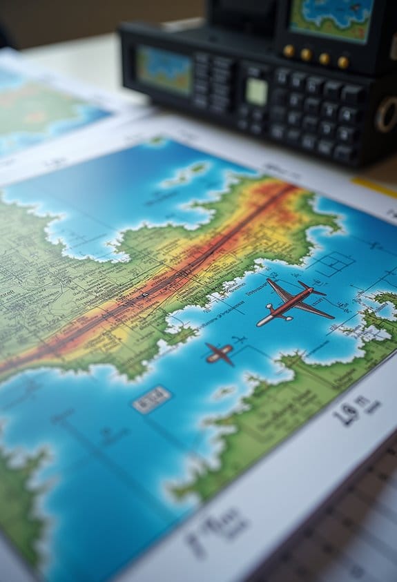
Choosing the right flight routes is super important if we want to cover an area effectively, especially when we’re out there gathering images or data. Think of it like planning a road trip; you want to make sure you hit all the best spots. First off, calculate your overlaps. A good rule of thumb is to aim for at least 60% overlap in the direction you’re flying and 30% on the sides. This way, you won’t miss any crucial details.
Next, consider your aircraft’s specifications. Understanding its ground speed and altitude helps determine the best flight lines. For example, if your drone can fly at a higher altitude, you could cover more area in less time. So, figuring that out can really save you both time and energy during your flights.
Don’t forget about the terrain and environmental conditions, either. You want to avoid any large obstacles and make sure you can access emergency landing sites along your route. Lastly, strategically placing waypoints is a must. Set them up in key locations before and after the flight boundary. It’s a bit like marking your map, which ensures that navigation through your coverage area is smooth and organized.
Using intelligent flight modes can also improve efficiency by automating parts of the route and enhancing consistent coverage.
Now that we’ve covered the basics of route selection, let’s talk about optimizing the timing of your flights for the best lighting conditions!
How to Tackle Weather Challenges on Your Aerial Missions?
When it comes to our aerial missions, tackling weather challenges is a key part of the process. Planning our flight routes is important, but if we overlook the weather, it could derail everything. Before we even think about taking off, we should check METAR, TAF, and PIREP reports. These give us a solid overview of the current weather conditions, helping us ensure that visibility, safety, and image quality all match what we’re aiming for.
It’s not just about the reports, though. We also need to keep an eye on local weather updates, like wind speeds and storm warnings—these can really impact how well our flights perform. For instance, if we’re flying a drone for aerial photography, strong winds can make it tough to capture steady shots. And if a storm pops up unexpectedly, having a backup plan becomes crucial.
To keep everything running smoothly, we might want to utilize Flight Service Stations for solid weather briefings. This is like getting a sneak peek into what’s ahead. It’s also wise to map out alternative routes and landing sites, just in case the weather takes a turn. Choosing the right time to fly is essential too; for instance, opting for morning flights when conditions are typically calmer can make a big difference. After all, a little preparation can be the secret to a successful mission! Using high-quality filters made from Schott B270 glass can also help maintain image clarity even in challenging light conditions.
Practical Flight Planning Tools for Your Aerial Missions
When we start planning our aerial missions, using practical flight planning tools can really help us meet our goals safely and efficiently. Have you ever tried using an electronic flight bag? It’s pretty neat! It automatically crunches the numbers you need based on your aircraft type and the current weather, so it’s like having a co-pilot helping you with the math.
For example, tools that give us METAR and TAF reports can tell us how the weather might affect our flight paths. This ensures we stay safe while also maximizing our fuel efficiency—no one wants to run low on gas mid-air! Plus, flight planning software can assist in figuring out how much fuel you’ll need or the best altitude to fly at, whether you’re sticking to Visual Flight Rules (VFR) or Instrument Flight Rules (IFR).
And don’t forget about weight and balance calculators! They help us ensure everything—fuel, passengers, and cargo—is loaded just right to keep the aircraft stable, especially during larger missions. So, these tools not only make our lives easier, but they also play a key role in keeping our flights safe. What about you? Have you used any specific tools that made planning easier? Integrating advanced flight planning tools that incorporate obstacle avoidance features can further enhance mission safety and efficiency.
Communicating Effectively With Flight Service Stations
You know, effective communication with Flight Service Stations (FSS) really enhances our flight planning and in-flight safety. When we’re getting ready for a flight, whether we’re flying visually or using instruments, it’s super important to share key details like what type of aircraft we’re flying, our planned route, expected altitude, and when we plan to take off. This helps ensure everything is accurate and that we’re following regulations.
FSS personnel are a great resource for gathering important info—think about weather updates, NOTAMs (Notices to Airmen), and airspace restrictions. For instance, if you’re planning a flight through an area that’s experiencing stormy weather, they’ll let you know what to expect and help you adjust your route if needed. It’s also crucial to update them if something changes in your flight plan, like a new departure time or a different altitude—this keeps everyone on the same page. Just as vibration dampeners enhance performance by reducing unwanted effects, maintaining clear communication with FSS helps minimize risk factors and improve overall flight safety.
Frequently Asked Questions
What Are the 5 C’s in Aviation?
The 5 C’s in aviation—Climb, Communicate, Confess, Comply, and Conserve—embody key concepts for cockpit coordination. By ensuring critical checks and crew collaboration, we’re better equipped for effective contingency planning and an all-encompassing checklist.
What Is the 3 4 3 Layout in Flight?
The 3 4 3 layout enhances flight efficiency for large area coverage. By employing smart navigation techniques, we guarantee spatial awareness, maximizing overlap for effective data collection during our large-scale planning efforts.
What Is the App That Creates Flight Plans?
Did you know that over 70% of pilots use flight planning software? We recommend aerial navigation tools like ForeFlight and drone flight apps for flight route optimization, along with aviation weather apps for effective mission planning solutions.
What Is the 3 to 1 Rule for Pilots?
The 3 to 1 concept guides our descent planning; for every 1,000 feet of altitude, we need 3 nautical miles for a safe approach angle, ensuring proper glide slope and landing efficiency through effective altitude management.