As an Amazon Associate, we earn from qualifying purchases. Some links on this site are affiliate links at no extra cost to you. Our recommendations are based on thorough research and editorial judgment.

How Drones Support Construction Site Documentation
Drones support construction site documentation by greatly speeding up the process and enhancing accuracy. We can reduce documentation time by up to 95%, capturing high-resolution images that are timestamped and geotagged. This guarantees organized evidence of site conditions, mitigates disputes, and keeps everyone aligned on project status. By integrating drone data with project management tools, we improve oversight, safety, and accountability. There’s so much more to explore about how drones are changing the construction landscape.
Key Takeaways
- Drones reduce documentation time by up to 95%, allowing for faster collection of site data and images.
- High-resolution images are timestamped and geotagged, providing organized and credible evidence of site conditions.
- Drones support continuous monitoring, enabling regular visual updates on construction progress for all stakeholders.
- Using drones enhances safety by conducting inspections in hazardous areas without putting workers at risk.
- Accurate drone documentation helps align project teams and ensures compliance with local building codes, reducing disputes.
The Impact of Drones on Construction Site Documentation

Hey there! Have you ever thought about how drones are transforming construction site documentation? These remarkable flying machines are drastically changing how we collect and manage important project info. For example, instead of spending days walking around a site taking photos, a drone can zip around and capture stunning, high-resolution images in a matter of minutes. That speeds up our documentation time by as much as 95%!
What’s really cool is that drones don’t just snap pretty pictures. They create timestamped and geotagged photos, which means we have clear and organized evidence of what’s happening on-site. This feature helps prevent disputes between contractors and teams, making everything run smoother and more accountable.
Let’s break down how these aerial helpers make our jobs easier. First, they allow us to gather a ton of baseline data before construction kicks off. Picture this: a comprehensive aerial view of the entire site before any work starts. Then, throughout the construction process, drones provide real-time updates with visual records that keep everyone in the loop. They also help ensure that everything is compliant with regulations and that billing is accurate, reducing potential hiccups. Additionally, drones equipped with GPS-based auto-return features improve safety by preventing losses and crashes during complex site surveys.
Why Accurate Site Documentation Matters in Construction

Hey there! So, let’s talk about why accurate site documentation is such a big deal in construction. It’s not just about filling out forms; it actually plays a crucial role in how well a project runs. Think of it this way: having solid documentation helps us stick to local building codes and avoid unnecessary delays. For example, when we take timestamped photos of the work as it progresses, it creates a visual record that can really clear up any misunderstandings later on.
Another plus is that this kind of documentation keeps everyone in the loop—whether it’s the contractors, clients, or team members. If there’s a disagreement about what’s been done, those photos and notes can show exactly what the status is. Plus, by keeping everyone aligned, we can coordinate timelines better, which means smoother sailing as the project moves forward. Overall, when we put a little effort into accurate site documentation, we set ourselves up for success down the line! Now, let’s explore how these processes can be integrated into daily operations using drones equipped with advanced stabilization technology to capture smooth, detailed aerial views…
Top Benefits of Drone Technology for Construction Documentation

Hey there! You know, the world of construction is changing, and drone technology is playing a big role in that shift, especially when it comes to documentation. Imagine being able to capture stunning high-resolution aerial images of a construction site without the hassle of climbing ladders or using scaffolding—sounds pretty cool, right?
One of the best things about using drones is how they create detailed archives. They can snap photos before a project even starts, while it’s in progress, and when it’s all wrapped up. Plus, these images are automatically timestamped and geotagged, which comes in handy for keeping track of compliance and any regulatory requirements. For example, if you’re overseeing a large project and need to show that everything is done according to the plan, those drone images can save you lots of headaches.
Another great benefit is how drones support continuous monitoring. Imagine sending a drone up every week to track how construction is progressing—the project manager can spot any potential issues or delays right away. This real-time oversight can lead to quicker decisions around safety inspections or project adjustments.
Finally, there’s an excellent integration capability with tools like Building Information Modeling (BIM) and Computer-Aided Design (CAD). The top-notch data drones collect can be easily fed into these systems, helping teams plan in a more precise way. This smooth integration reduces the chances of miscommunication and helps keep everyone on the same page.
In addition, drones equipped with GPS functionality provide precise navigation and safe flight operations, which improves the quality and reliability of the documentation.
All in all, embracing drone technology can drastically improve how we handle construction documentation, making the process smoother and more insightful. It’s exciting to think about where this technology will take us next!
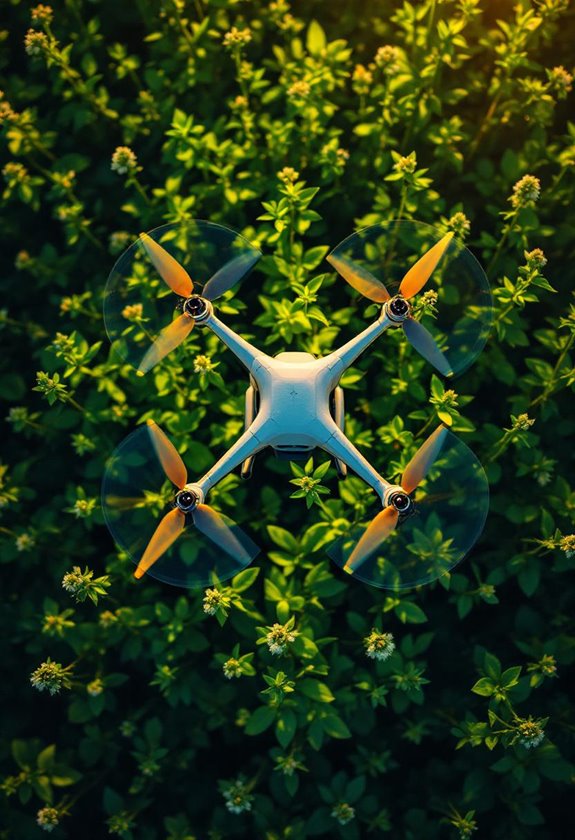
How Drones Capture High-Resolution Aerial Imagery
You know, when we talk about capturing high-resolution aerial imagery, drones really change the game for documenting construction sites. With drones, we can quickly and easily survey a site, snapping detailed images that really enhance our visual documentation. It’s way faster than the old methods; for example, instead of climbing scaffolding or using a helicopter, you can just send a drone to get those hard-to-reach angles.
The cool part? You can program these drones to fly specific routes regularly. This means they can help monitor the progress of a project over time, so nothing slips through the cracks. Plus, when we combine those drone images with tools like Building Information Modeling (BIM) and Computer-Aided Design (CAD), we get an even clearer picture of the project—like assessing how it might impact the environment or keeping an eye on everything happening on-site.
It’s pretty remarkable how much more efficiently we can work now! And as these technologies continue to evolve, just imagine how they’ll shape future construction projects. Utilizing advanced 8GHz transmitters in drones ensures a seamless connection and reliable data transmission during these aerial surveys.
Integrating Drone Data With Project Management Tools
Hey there! Have you ever thought about how integrating drone data with project management tools can really change the game in construction? It’s fascinating! Imagine being able to see real-time aerial views of a construction site. With this technology, you can easily compare what’s happening on the ground to the original plans, ensuring everything stays on track.
For instance, if a building is supposed to reach a certain stage by next week, you can quickly check the drone footage to see if they’re on schedule. This not only helps in keeping everyone informed but also eliminates a lot of the manual paperwork. Plus, with everything timestamped and tagged to specific locations, it increases accountability among team members.
Additionally, drone data helps us make smart decisions on how to allocate resources. Let’s say you notice a delay in a particular area—this information allows you to adjust your materials or personnel right away. So, it’s not just about tracking progress; it’s about improving how we manage and execute construction projects. And that’s just scratching the surface of what’s possible! Thinking about how all of this data can tie into more strategic decision-making opens up a whole new world. Leveraging drones equipped with high-resolution cameras also enhances the detail and accuracy of site documentation.
Streamlining Progress Monitoring With Drone Technology
Hey! You know how keeping track of construction progress can sometimes feel like a juggling act? Well, streaming progress monitoring on construction sites with drone technology can really change the game. By using drones, we can snap high-resolution images every week, which gives us detailed visual updates that are super helpful for managing construction projects.
For instance, instead of having to take manual notes or photos, which can be pretty time-consuming, drones do all the hard work for us. This means we can spend more time focusing on getting things done and less time worrying about documentation. Plus, with the images they provide, we can easily spot any differences between what’s been built and what was originally planned. So if something’s not quite right, we can jump on it and fix it quickly.
Another cool thing is the 3D models and aerial surveys that drones create. These visuals make it a lot easier for everyone involved to see what’s going on and share updates. It really helps keep communication clear and cuts down on misunderstandings. So, overall, using drones not only keeps our projects on schedule and budget but also brings everyone on the same page. Doesn’t it make you think about how tech can really help with complex tasks like these? Additionally, the 3-axis gimbals in drones help capture stable images even in windy conditions, ensuring consistent documentation quality.
Enhancing Safety Inspections and Communication With Aerial Views
You know, safety on construction sites is super important, and drones are really making a difference. Flying drones around for safety inspections means we can check out potentially dangerous areas without putting workers directly in harm’s way. Imagine having a bird’s-eye view of the site! You can spot issues like loose scaffolding or improper safety gear much quicker than on foot.
One of the coolest things about using drones is that we can get real-time updates while the work is happening. For instance, if we see something that doesn’t look right, like a structural problem in the roof, we can flag it immediately and address it before it becomes a bigger issue. Plus, it makes it a lot easier to share what we see with everyone involved in the project. Sending clear images and videos to clients or team members helps keep everyone on the same page regarding safety compliance.
Ultimately, drones support better inspections and communication, making construction sites safer for everyone. Thanks to features like electronic image stabilization, the aerial footage is incredibly smooth and clear, improving the quality of the data collected during inspections. And speaking of communication, let’s explore how these aerial views can foster deeper collaboration among the project teams!
Real-World Examples of Drone Success in Construction
Have you ever wondered how drones are making waves in construction? It’s pretty fascinating! Across the globe, drones are really changing the game by making construction projects faster and more efficient. For example, a project in India managed to trim down their site surveying time and costs by a remarkable 60%. That’s huge!
Drones are not just for taking fun pictures either—they’re practical tools. One major infrastructure project used drones to capture weekly aerial images, which helped the team keep track of progress with clear visual reports. This kind of accountability is a big deal when managing complex projects.
Another interesting case is how a construction company used drones to document conditions before construction began. Those timestamped and geotagged images led to a 30% drop in disputes, since everyone could clearly see what the site looked like before any work started. Plus, for a large commercial project, drones were used to create detailed 3D models, which helped with better calculations of materials needed.
Oh, and let’s not forget about safety. In the U.S., using drones for inspections has led to a noticeable decrease in accident rates—over 40%! This means that construction teams can ensure a safer environment while keeping their projects compliant.
Additionally, leveraging drones with geo-tagging capabilities enhances the precision and usefulness of site data.
With all these benefits, it’s clear that drones are proving to be an invaluable asset in the construction world. They not only save time and money but also enhance safety and transparency. What other technologies do you think could have a similar impact in different industries?
The Future of Drone Technology in Construction Documentation
Hey! Have you ever thought about how drone technology is changing the way we handle construction documentation? It’s pretty amazing! With advanced features like high-resolution cameras and LiDAR, drones can gather incredibly detailed images of construction sites. This means we can spot potential problems before they turn into expensive mistakes.
Imagine walking onto a construction site and immediately getting a clear overview of the entire area, all thanks to a drone flying overhead. Plus, when we combine these drones with Building Information Modeling (BIM), it’s like having a living blueprint. We can keep track of progress in real-time and update our records instantly, so everything stays as accurate as possible. For example, if a wall was shifted or an addition was made, the drone can show exactly how that change impacts the overall plan.
Another cool feature is the ability of drones to monitor the environmental conditions around a site. This helps ensure we’re sticking to safety and environmental regulations and provides documentation we can show to inspectors. As we keep looking at how drone technology evolves, it’s exciting to think about how it will make construction projects smoother and more efficient.
Best Practices for Documenting Construction Projects With Drones
You know, if you’re thinking about how to document a construction project more effectively, using drones can really change the game. Imagine being able to capture stunning aerial images of your site without all the hassle of walking around or climbing ladders. Instead of spending hours on manual inspections, you can use drones to gather all that information quickly and accurately.
One great way to start is by scheduling regular drone surveys. This means setting up times to fly the drone over the site to take high-resolution photos. Not only can you see how the project is progressing in real time, but you can also easily spot changes and address any issues that pop up. For example, if there are delays due to weather or materials, you can document it immediately and keep everyone in the loop.
It’s also super important to work with a reliable drone service provider. They know the ins and outs of local regulations, which helps keep everything above board. Plus, they can help ensure that you get consistent results every time. And don’t forget about the unique angles drones can provide—it’s a great way to access hard-to-reach areas that would be tricky from the ground. Think of it as having a bird’s-eye view of your project!
Lastly, remember to make use of timestamped and geotagged images. This adds a layer of accountability and can help resolve disputes if there’s ever any confusion about what was done and when. Using drones with GPS capabilities further enhances accuracy and safety in construction site documentation. So, if you’re keen on keeping clear records while boosting your efficiency, drone documentation is worth looking into. Now, let’s explore some tech tools that can complement your drone’s capabilities.
Frequently Asked Questions
What Types of Drones Are Used in Construction Documentation?
In construction documentation, we often use survey drones, inspection drones, and mapping drones for aerial photography and 3D modeling. Thermal drones, LiDAR drones, and autonomous drones enhance our surveying applications and streamline processes effectively.
Are There Legal Regulations for Drone Usage in Construction?
Yes, there’re legal regulations we must follow for drone usage in construction. From operator certifications and usage permits to privacy concerns and airspace restrictions, understanding these safety guidelines and insurance requirements is essential for safe operations.
How Long Does Drone Data Collection Take?
Drone data collection typically takes less time than traditional methods. We’ve seen improvements in data collection speed, aerial survey duration, and workflow integration speed, markedly impacting project timelines and meeting surveying frequency expectations efficiently.
What Is the Cost of Integrating Drones Into Construction Projects?
You know what they say, ‘A penny saved is a penny earned.’ Drone investment costs involve software integration expenses, training program costs, and maintenance analysis, but yield long-term savings and competitive advantages in operational efficiency and project timelines.
Can Drones Operate in Adverse Weather Conditions?
Drones can operate in certain adverse weather conditions, but their durability and weather resistance are vital. With proper pilot training, flight stability, and real-time adjustments, we can maintain data accuracy while evaluating operational limits and implementing emergency procedures.