As an Amazon Associate, we earn from qualifying purchases. Some links on this site are affiliate links at no extra cost to you. Our recommendations are based on thorough research and editorial judgment.
What Is Aerial Photography and How Does It Differ From Traditional Photography
Aerial photography captures images from high above using drones, helicopters, or airplanes, which gives us unique perspectives on landscapes and urban environments. Unlike traditional photography, which focuses on ground-level detail, aerial methods cover vast areas quickly. This approach provides benefits like breathtaking views, extensive coverage, and insightful data for fields like agriculture. However, aerial photography can be costly and has technical challenges. Continue with us to explore how each method suits different photography needs.
Key Takeaways
- Aerial photography captures images from above using drones, helicopters, or airplanes, providing a unique perspective of landscapes and urban layouts.
- Traditional photography focuses on close-up images, detailed moments, and scenes captured from eye level, offering intimacy and control in composition.
- Aerial photography utilizes advanced technology like high-resolution cameras and GPS for precise location data, while traditional photography generally relies on manual camera controls.
- Aerial photography can cover large areas quickly, while traditional photography excels in low-light situations and detailed work in controlled environments.
- Budget considerations and technical knowledge differ significantly between both methods, with aerial photography typically requiring more investment and expertise.
What Is Aerial Photography and How Does It Work?
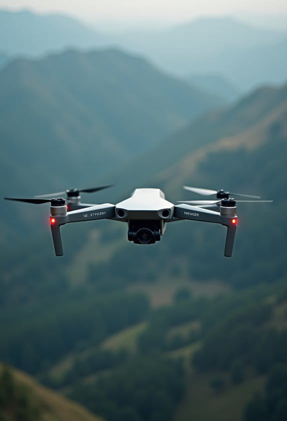
Hey! Have you ever thought about aerial photography? It’s such a cool way to capture stunning images from above using tools like drones, helicopters, or airplanes. What I love about aerial photography is how it gives us a fresh perspective, letting us cover large areas quickly—think about how useful that is in fields like real estate, where you want to show off a property’s surroundings, or in environmental monitoring, where you’re tracking changes in landscapes.
When we take aerial photos, we usually use high-resolution cameras, especially when shooting from altitudes of over 10,000 feet. For instance, a real estate agent might take a shot of a large estate that captures not just the house but the entire yard and nearby amenities. And here’s something interesting: we incorporate GPS technology in our shots, which adds precise location details. That can really help when creating maps or gathering data.
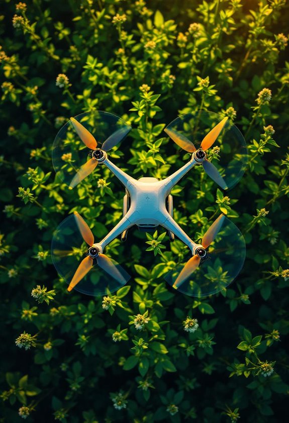
With the latest advancements in drone technology, aerial photography has become more accessible. It’s fascinating to see how this technique is being applied across different fields, from agriculture to surveying. If you’re ever interested in giving it a try, there are plenty of beginner-friendly drones available that can help you capture your own amazing aerial views! Many of these drones come equipped with intelligent flight modes that make capturing professional-grade images easier for beginners.
Comparing Aerial vs. Traditional Photography
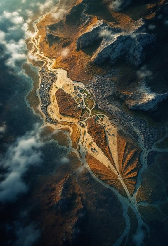
Aerial photography and traditional photography are like two sides of the same coin, each with its own flair and purpose. Aerial photography, often done with drones or planes, captures images from high above, revealing stunning views of landscapes and city layouts that you just can’t see from the ground. For example, think about how a bird’s-eye view can show you the cool patterns of a sprawling city or the intricate details of a winding river.
On the other hand, traditional photography zooms in on the here and now. It’s all about capturing those beautiful moments up close, like a portrait of a loved one with natural lighting to highlight their features. Traditional photographers get to play with the surroundings and create a sense of intimacy that helps tell a more personal story.
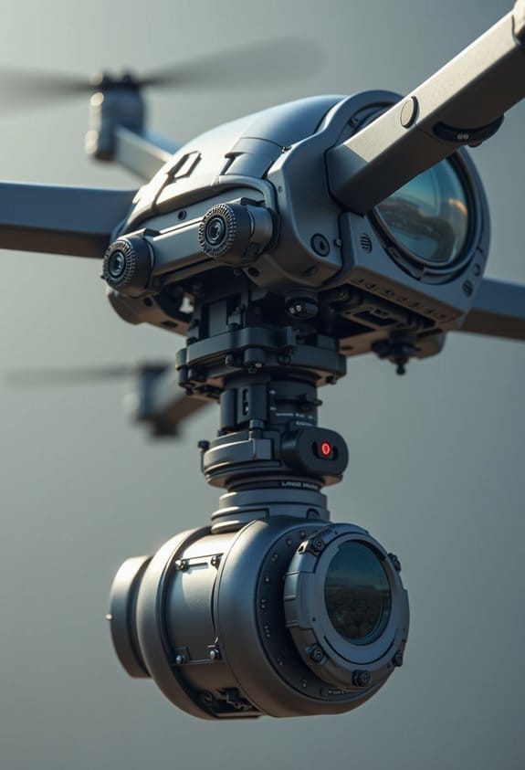
The rise of drone technology has made aerial photography even more accessible, allowing photographers to grab high-quality images quickly and efficiently. It’s fascinating how easily you can now snap a stunning shot of a mountain range or an urban landscape without having to hike up a peak or climb a building. Both types of photography have their own unique advantages and are essential for showcasing the beauty of our world in different ways. It’s exciting to think about how these methods can complement each other as new technology continues to evolve! One significant advancement enhancing aerial photography is the integration of obstacle avoidance systems in drones, which improve safety and reliability during flights.
Recommended Products

【Drones with 4K Camera & Obstacle Avoidance】Our V168 drones with camera for adults 4k are equipped with a 90° adjustable lens and 120° wide-angle lens, allowing you to capture from multiple angles with ease. An SD card and card reader are included for easy storage and sharing of photos and videos. In addition, our V168 drone is equipped with 4-way obstacle avoidance (Only work indoor), which can automatically detect and avoid obstacles during flight, effectively reducing the risk of collision

【Drone with Camera for Adults】Although the TT19LCD is not a drone with 4K camera, it features a FPV HD camera with a 90° electrically adjustable remote lens. From continents to oceans, forests to mountains, it delivers rich image detail and accurate color reproduction. The video&Image looks sharper and smoother than that from many 720p and 1080p drones. With easy operation and versatile functionality, you can effortlessly capture stunning aerial footage. Additionally, the second camera—optical flow camera—continuously analyzes ground image data during flight, enabling precise hovering positioning even in small indoor spaces.
Benefits of Aerial Photography: Unique Perspectives and Extensive Coverage
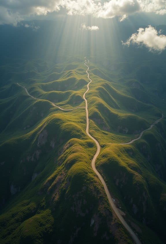
You know, when we usually think about photography, it’s all about capturing those close-up moments—like a sunset or a family gathering. But aerial photography? That’s where things get really exciting! It offers this whole new way to see things from above, revealing breathtaking landscapes and the tiny details we often overlook from the ground. Imagine seeing the patterns of fields or how urban areas are growing—these insights are pretty tough to spot without that bird’s-eye view.
Using drones, or what they technically call Unmanned Aerial Vehicles (UAVs), is a total game changer in this space. They’re super efficient for covering large areas quickly. For example, if you wanted to check on a construction site, a drone can zip around to take visuals in just minutes, rather than having to wait for a helicopter. Plus, it’s a lot kinder on the budget! Aerial photography is becoming more affordable, allowing you to capture stunning views from tricky locations without breaking the bank. Advanced aerial platforms often integrate NDVI imaging technology to provide valuable data for agriculture and environmental monitoring.
Recommended Products

【𝗜𝗡 𝗦𝗘𝗔𝗥𝗖𝗛 𝗢𝗙 𝗧𝗛𝗘 𝗜𝗗𝗘𝗔𝗟 𝗙𝗟𝗜𝗚𝗛𝗧, 𝗖𝗔𝗣𝗧𝗨𝗥𝗘 𝗬𝗢𝗨𝗥 𝗔𝗘𝗥𝗜𝗔𝗟 𝗠𝗢𝗠𝗘𝗡𝗧𝗦】Are you spending more for better aerial footage or settling for a budget drone with poor image quality? The Gleesfun G11PRO is the perfect choice. This affordable drone features a sleek design, FAA compliance, and carrying case. With a 3-axis brushless gimbal, 10000ft GQ2.0 digital transmission, and up to 70mins flight time, it delivers smooth, stable, professional-grade shots. Capture 6K photos and 4K/30fps video with stunning clarity, and enjoy effortless aerial photography with cruise modes.


Drawbacks of Aerial Photography: Costs and Technical Challenges
Hey, have you ever thought about the incredible visuals you can capture with aerial photography? It’s amazing how expansive and breathtaking those bird’s-eye views can be. But let me tell you, there are some drawbacks you need to be aware of.
First off, aerial photography can really put a dent in your wallet. You’re looking at some serious costs if you want to invest in a good drone or aircraft along with a high-resolution camera. For example, a decent drone can set you back several hundred to a few thousand dollars. Not to mention, you also need to budget for spare batteries and maintenance.
Then there’s the technical side of things. Mastering the controls of a drone isn’t as easy as it looks. You’ll need to understand everything from the camera settings to the local regulations about flying in certain areas. Plus, if you want those stunning shots, you might need to check the weather conditions beforehand. A cloudy, rainy day can ruin your plans and affect image quality.
And let’s not forget about equipment risks! Imagine you’re soaring high, capturing that perfect landscape, when suddenly the battery hits low power. That’s a stressful situation! It’s crucial to keep an eye on battery levels and signal strength to avoid a crash.
Finally, don’t overlook the legal side. Many places require you to have a license before you can fly, which can complicate your photography adventure. It’s definitely a lot to juggle, but once you get the hang of it, the rewards can be well worth the effort.
Also, many drones come with safety features such as emergency stops and low power alarms that help mitigate risks during flight.
Now that you have a clearer picture of what’s involved, let’s chat about the creative side of aerial photography—how to capture stunning landscapes like a pro!
Recommended Products

🛬【25C Drone Lipo Battery】Suitable for Syma Q11 H99W H31 H6C H98 TR-C385 TR-P51 TR-F22 Quadcopter Part (PLEASE NOTE the voltage/size/plug of the 3.7V lipo battery)

For H99W H31 H6C H98 AT-96 TR-C385 TR-P51 TR-F22 SYMA Q11 quadcopter

Package Dimensions: 10.6 H x 3.8 L x 10.2 W (centimetres)
Advantages of Traditional Photography: Detail and Control
You know, when we talk about traditional photography, one of the coolest things is the level of detail and control it gives us as photographers. Imagine being in a studio where you can set up your lighting just right and choose your backdrops to create the perfect mood for a shoot. This control is super important for capturing those little details, especially in portrait and macro photography. For instance, when snapping a close-up of a flower, you can really play with the lighting to highlight each petal’s texture.
Another advantage is that traditional photographers usually work with larger image sensors, which means they can handle low-light situations much better than something like aerial photography. Think about shooting a wedding indoors—the ability to catch all the subtle moments without a flash can be a game saver. Plus, traditional setups are generally less expensive than aerial ones. This accessibility allows us to take on a broad range of projects without breaking the bank. However, for capturing expansive views and dynamic motion, aerial photography offers unique advantages with its GPS navigation features that ensure stable and precise flight paths.
Limitations of Traditional Photography: Perspective and Environmental Constraints
You know, traditional photography really shines when it comes to detail and control, but it does have some quirks—especially around perspective and environmental factors. For one, ground photography tends to stick to eye-level shots. This can limit us, making it tough to capture those breathtaking landscapes or shots blocked by buildings or trees. Imagine trying to photograph a stunning sunset, only to be obstructed by a crowd of people!
Weather and lighting can throw a wrench in our plans too. Sure, you can zoom in and capture intricate details like the texture of a flower, but you might miss out on those dramatic high-angle shots that really tell a story. Accessibility plays a role as well; some breathtaking spots require climbing or special gear, which can be a bummer. Plus, in low-light situations, traditional cameras struggle to keep up. That’s where aerial photography shines—it’s perfect for capturing those incredible patterns and perspectives that ground techniques often miss. It’s fascinating to see how these different styles of photography complement each other! Drone technology with advanced stabilization helps achieve smooth and professional aerial shots even in challenging conditions.
Recommended Products

SIYI A8 mini 4K AI Mini Zoom Gimbal FPV Camera,AI Smart Identify Tracking

No Registration Needed - Under 249 g, this drone with camera for adults 4K does not require FAA registration or Remote ID for recreational use. Visit the FAA's official website for requirements related to drone registration and Remote ID. [1]

No Registration Needed - Under 249 g, this drone with camera for adults 4K does not require FAA registration or Remote ID for recreational use. Visit the FAA's official website for requirements related to drone registration and Remote ID. [1]
How to Pick the Best Photography Method for Your Needs?
Choosing the right photography method for your needs can be a fun yet tricky decision! First off, think about what the project is all about and what you’re hoping to achieve. For instance, if you’re aiming to capture breathtaking landscape shots or get those unique angles that make people say “wow,” aerial photography is the way to go. It’s super handy for real estate listings, too, as it gives potential buyers a fantastic view of properties and their surroundings that they can’t get from the ground.
On the other hand, if you want to capture the essence of a person or focus closely on animals, traditional photography is your best bet. High-resolution cameras shine in these situations, especially in dim light where details really matter. For example, snapping a cozy family gathering at sunset allows you to capture heartwarming moments everyone will cherish.
Additionally, advanced drones with features like 360-degree obstacle avoidance provide safer and more flexible aerial shooting options for professionals.
Recommended Products

【6K Ultra HD + 3-axis Brushless Gimbal】 Adopting a professional imaging system and imported sensors, Bwine 18MP camera drone captures sharp 6K photos and fluent 4K 30fps videos. The 3-axis brushless gimbal raises stability accuracy by 300%, keeping steady in strong winds and high-speed flight. Perfect for extreme outdoor lovers, farm and ranch inspection, it lets you record fine scenery effortlessly.

Screen Controller, No Phone Needed: This drone comes with a 4.5-inch remote controller with a built-in screen, making connection simple and convenient. No smartphone connection or app download is required, allowing you to fly and view real-time footage directly on the controller. Without distractions from incoming calls, messages, or notifications, you can enjoy an immersive flying experience. The all-in-one design also reduces reliance on mobile devices.

【A Fun Tech Gift for Him】 The perfect high-value tech gift for Father’s Day, birthdays or holidays. Whether for parent-child activities or capturing travel memories, this drone brings families together through the joy of flight.
Frequently Asked Questions
What Is Aerial Photography in Simple Terms?
Aerial photography’s all about using drone technology to capture stunning sky visuals. We get unique vantage points and creative perspectives, perfect for landscape exploration and geographical mapping, showcasing photography techniques previously unattainable from the ground.
What Is Digital Photography and How Is It Different From Traditional Photography?
Like a painter with a digital canvas, we’re capturing moments through advanced camera technology. Digital photography enhances resolution quality, light manipulation, and image editing, enabling rich visual storytelling that traditional techniques simply can’t match.
What Is the Difference Between Aerial Photography And?
Aerial photography’s unique perspectives enhance our visual storytelling, utilizing advanced photography techniques and equipment. With drone usage, we capture higher image resolution and geographic impacts, setting it apart from traditional photography methods.
What Is Aerial Photography in AP Human Geography?
In the vast canvas of AP Human Geography, aerial imagery paints vivid portraits of landscapes, enhancing our geographic analysis and spatial understanding. By employing drone technology, we refine urban planning and assess environmental changes with precision.